|
NeilsYard
Coventry |
16 of 32
Fri 30th Jun 2023 2:56pm
Brill again Helen. I never know which is the best map to use. Do you know the date of that one? |
| Local History and Heritage - Health of the City | |
|
Helen F
Warrington Thread starter
|
17 of 32
Fri 30th Jun 2023 3:25pm
That's the 1887 map but the 1905 one is just as good. To trace the court I had to read the relevant pages about what was done under the Housing Acts. Some were demolished, some were shut pending action, some were reopened following work. I had to look at each map location and compare with the photographs. Those houses had street numbers that I found using the Fire Insurance map, which also told me that the 3 storey building was brick and timber, denoting how old it was. I've done most of the ones at the Wellcome Collection but there were a few others that I photographed at the Herbert. Three of those I can't work out because I didn't photograph the 2/3 pages listing the Housing of the Working Class Act actions for 1899, 1901 and 1903. I haven't worked out all the slaughter houses either but there is a list of them that I intend to look up at the Herbert when I'm there next. I only worked out the one on Jordan Well because they also closed the buildings on the street front.
Incidentally, apart from the Bell Inn on the junction of Warwick Lane and Grey Friars Lane, all the buildings on the inside of that upside down V were either erected new or rebuilt from outside the gatehouse. The land remained empty of buildings except for the ruins of the church until the Civil War. This was partly because the land wasn't needed because the population was repeatedly decimated by plague but I imagine there was a certain amount of feeling it would be disrespectful... no wrong word because the lands were used for animals, bad karma to live there. The other church lands seem to have remained relatively untouched until the same time. So Priory Row and New Buildings were also vacant and ready for those having to leave the shadow of the gatehouses. Only White Friars was relatively untouched until the 1800s. |
| Local History and Heritage - Health of the City | |
|
Helen F
Warrington Thread starter
|
18 of 32
Fri 19th Apr 2024 4:10pm
A continuation of identifying images from the annual health reports brought up these two. They turn out to be Court 3 off New Buildings closed in 1899. The first looks south and the second looks to the west. Beyond those would have been the cattle market or even further back in time, the priory mill pool.
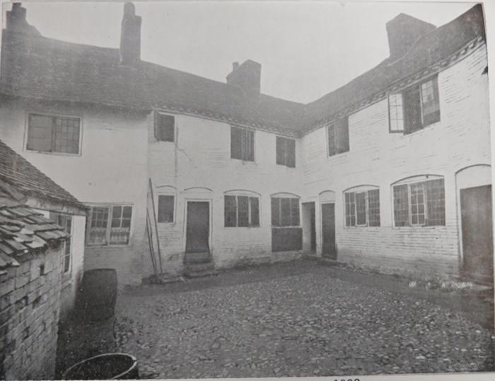
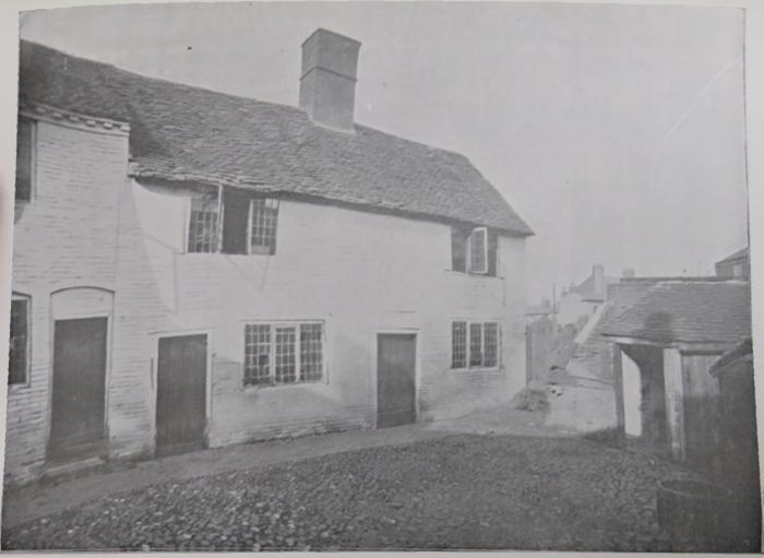
|
| Local History and Heritage - Health of the City | |
|
Helen F
Warrington Thread starter
|
19 of 32
Fri 19th Apr 2024 4:54pm
The window on the left of the first photo above is the window you can see at the back of this court. In the centre of this picture.
|
| Local History and Heritage - Health of the City | |
|
Helen F
Warrington Thread starter
|
20 of 32
Fri 19th Apr 2024 4:59pm
One more - this is a row of 4 condemned and voluntarily closed in 1901. They were off Leicester Street, south side, just before the split with the Leicester Causeway.
nb in case someone needs the reference - they were called the Leicester Cottages.
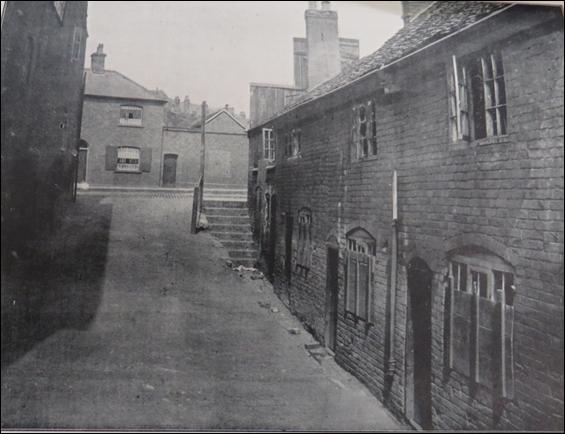 |
| Local History and Heritage - Health of the City | |
|
NeilsYard
Coventry |
21 of 32
Mon 22nd Apr 2024 3:16pm
Yet again - more Fabbo stuff Helen 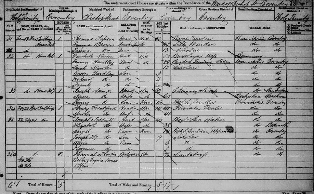
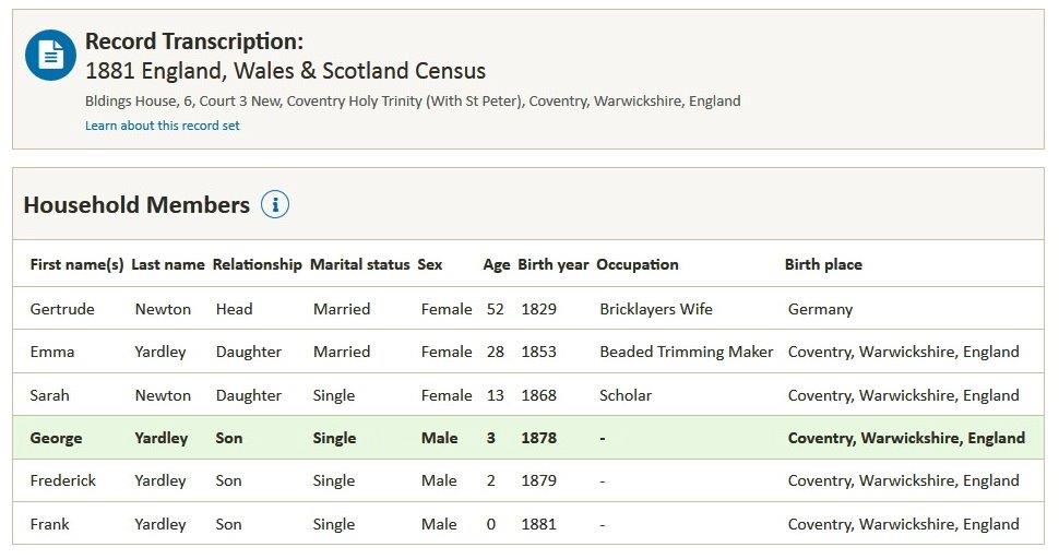 |
| Local History and Heritage - Health of the City | |
|
NeilsYard
Coventry |
22 of 32
Mon 22nd Apr 2024 3:31pm
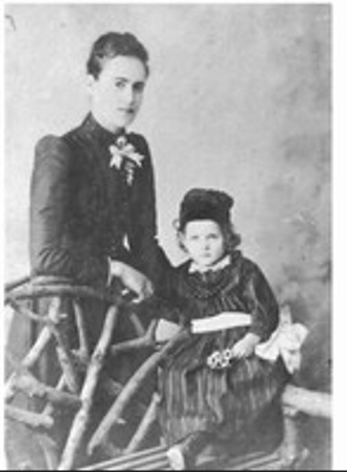
And I can even show you Emma - though we are not sure which one of the boys that is - possibly George as the eldest boy (so my Great Grandfather) -
|
| Local History and Heritage - Health of the City | |
|
Helen F
Warrington Thread starter
|
23 of 32
Mon 22nd Apr 2024 4:01pm
It's great to be able to help. |
| Local History and Heritage - Health of the City | |
|
NeilsYard
Coventry |
24 of 32
Mon 22nd Apr 2024 4:08pm
I thought I'd seen the pics before Helen but only you could ID them! |
| Local History and Heritage - Health of the City | |
|
Helen F
Warrington Thread starter
|
25 of 32
Tue 23rd Apr 2024 9:43am
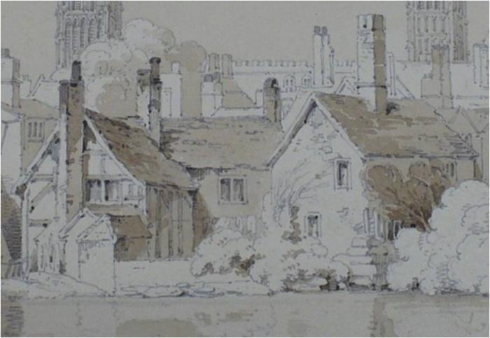
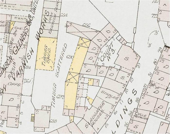
That court has to be one of my favourites. Not only does it appear in many of the most well known images of the spires and the mill pond, it shows an example of original cobbles. On the BoH map it was called Houghs Yard. The larger size of number 6 and 7 to the other court houses suggests a different age. Unlike the buildings along the road there's no evidence that these were half timber but they may have been brick clad earlier buildings eg a bake house.
Despite the almost idyllic appearance of the area in the sketches of the pool and the photos of the yard, according to the 1897 fire insurance maps the area was seriously grim. Slaughter houses to the south, timber milling to the north east, cattle market to the north, a varnish factory to the west and directly behind, a large covered store for wood. The pretty, timbered rear of the building fronting the the street had been replaced with lean to tiled extensions - so just a long roof. These photos don't appear under 'slum clearance' for nothing.
|
| Local History and Heritage - Health of the City | |
|
NeilsYard
Coventry |
26 of 32
Tue 23rd Apr 2024 9:49am
What a combination to be growing up in Helen! |
| Local History and Heritage - Health of the City | |
|
Helen F
Warrington Thread starter
|
27 of 32
Tue 23rd Apr 2024 10:39am
From a snippet of a Troughton drawing after the pool had been filled in, you can see the long roof that would have faced number 6. It was what was called a 'cat slide'. It's an important feature when trying to interpret maps. I made the mistake of assuming that if the fire map said that a building was 2 storey that it was all 2 storey. In this case the footprint of the building was made up of 2 storey, 1 storey and lower. Note the small shed at the end (see map to see that it's not a continuation of the roof).
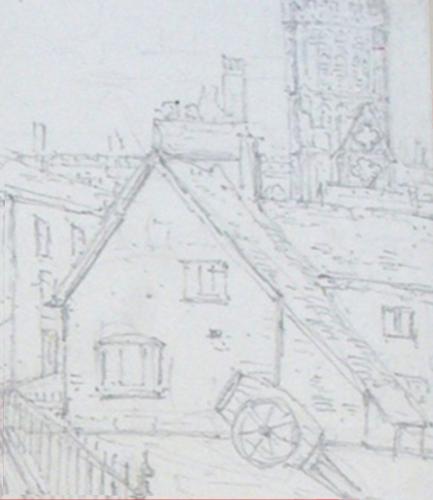
|
| Local History and Heritage - Health of the City | |
|
NeilsYard
Coventry |
28 of 32
Tue 23rd Apr 2024 12:05pm
It's amazing to see on BFA that Courts 5/6 appear to have lasted in to the 1950s, Helen -
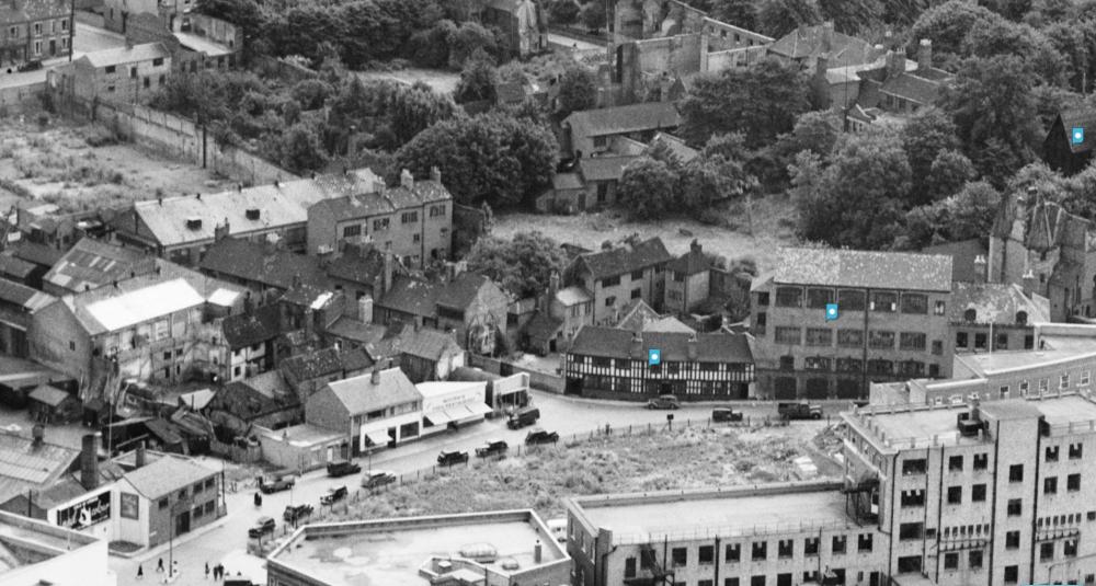 |
| Local History and Heritage - Health of the City | |
|
Helen F
Warrington Thread starter
|
29 of 32
Tue 23rd Apr 2024 12:48pm
And the very old mill in court 4. Have you tried to work out which aisle of Sainsbury's was their home? Now that would make for a novel haunting. |
| Local History and Heritage - Health of the City | |
|
NeilsYard
Coventry |
30 of 32
Tue 23rd Apr 2024 2:29pm
Yes I did try Helen! |
| Local History and Heritage - Health of the City | |
This is your first visit to my website today, thank you!
4,127,636Website & counter by Rob Orland © 2024
Load time: 635ms