|
montys mum
styvechale |
1 of 14
Sat 28th May 2016 5:35pm
I have recently discovered that the footpaths on Whitley Common South that have been used and enjoyed by many for well over 30 years, are not classed as "rights of way" as defined by the National Parks and Access to Countryside Act of 1949. As such they are not included on Coventry Council's Definitive Map and Statement of Public Rights of way and are subject to closure at any time the Local Authority decides. This has already happened to the top meadow at the Festival Island end of Leaf Lane since Costain were granted a licence to have a depot there and constructed a fence to separate the meadow from the rest of the common. I have been reliably informed that it is not proposed to remove this fence and that the land may be used for the grazing of animals in the future. This has come as a complete shock to residents in the neighbourhood as we were led to believe that the meadow was to be returned to its original state once Costain vacated it when the bridge to JLR was completed. It is my intention to apply for a Modification order to have the footpaths in and around the common designated as rights of way as having been used and enjoyed by the public for a continuous period of 20 years up to the date that Coventry Council and Costain restricted access. In order to achieve this I have to provide evidence including signed statements from persons who have used the footpaths over all or some of that time. I have the necessary forms and would be grateful if any reader who feels able and willing to provide this evidence would let me know and I will get the forms to you. Obviously the more evidence that can be gathered the greater chance of success. I can be contacted at hill-graham1@sky.com |
| Local History and Heritage - Whitley Common | |
|
PhiliPamInCoventry
Holbrooks |
2 of 14
Sun 29th May 2016 9:09am
Hello & welcome to our forum, Montys mum. |
| Local History and Heritage - Whitley Common | |
|
mick
coventry |
3 of 14
Sun 29th May 2016 12:33pm
My recollection is that the land between Leaf Lane and the Styvechale/Cheylesmore Bypass [as it was known] was bought as 'compensation' for the areas of Whitley Common that were taken for the construction of the road - so that even if the paths have no status the fields themselves surely do have. I think in the light of the ever-surrounding development this is an important buffer. |
| Local History and Heritage - Whitley Common | |
|
montys mum
styvechale Thread starter
|
4 of 14
Sun 29th May 2016 5:58pm
My understanding is that this land known as Whitley Common was designated as recreation ground by the Coventry Corporation Act of 1927. 33.5 acres between the London Road, Park Paling and Daventry Road were turned into playing fields. This now houses a play area and football pitches. The area which is of concern to me is between A444 and Leaf Lane, now called Whitley Common South. Obviously a great deal of land was taken up when the bypass was built. I am asking for anyone who has walked, run or otherwise enjoyed using the footpaths to get in touch so that I can issue evidence forms to them. We need to get them recorded as rights of way before the LA puts in more fences and who knows what else. |
| Local History and Heritage - Whitley Common | |
|
NeilsYard
Coventry |
5 of 14
Mon 12th Feb 2018 3:31pm
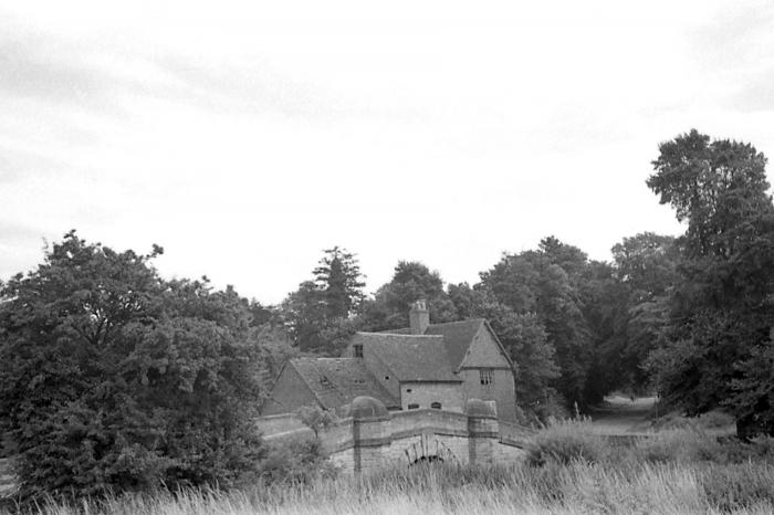
Not actually seen this mill before (apols if already posted somewhere on here - I did try to check). The bridge is still there though!

|
| Local History and Heritage - Whitley Common | |
|
Midland Red
|
6 of 14
Mon 12th Feb 2018 6:22pm
Can't believe it's not appeared on the forum before, Neil  . . and a photo of the bridge I took in 2010

|
| Local History and Heritage - Whitley Common | |
|
PhiliPamInCoventry
Holbrooks |
7 of 14
Tue 13th Feb 2018 7:27am
|
| Local History and Heritage - Whitley Common | |
|
NeilsYard
Coventry |
8 of 14
Mon 9th Nov 2020 3:16pm
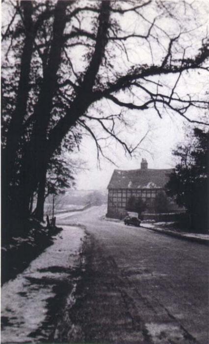
Abbey Road in 1940 looking towards the bridge and mill. Thanks to William Sutton - taken by his dad Alf.

|
| Local History and Heritage - Whitley Common | |
|
Helen F
Warrington |
9 of 14
Mon 9th Nov 2020 5:15pm
An interesting view of a familiar building, demonstrating that a brick building might be a lot older than it looks |
| Local History and Heritage - Whitley Common | |
|
NeilsYard
Coventry |
10 of 14
Tue 10th Nov 2020 3:13pm
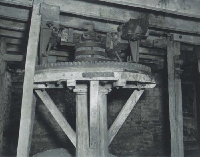
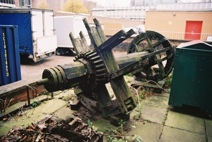
Someone had the forethought (pictures were from the Whitley History FB group) to preserve part of the mill workings before it was demolished.
 Though it was spotted languishing outside the back of the Motor Museum about 3 years ago and seems to have been disappeared now
|
| Local History and Heritage - Whitley Common | |
|
Robthu
Coventry |
11 of 14
Tue 10th Nov 2020 5:36pm
Talk is that it will be set up again on show as part of the Charterhouse project. |
| Local History and Heritage - Whitley Common | |
|
Robthu
Coventry |
12 of 14
Wed 11th Nov 2020 1:50pm
I have put on the gallery some pictures of Whitley Common/Mill. |
| Local History and Heritage - Whitley Common | |
|
NeilsYard
Coventry |
13 of 14
Wed 11th Nov 2020 3:38pm
Nice one, Derek - it's been seen recently then? |
| Local History and Heritage - Whitley Common | |
|
Helen F
Warrington |
14 of 14
Wed 11th Nov 2020 7:28pm
Lots of good photos there Derek. |
| Local History and Heritage - Whitley Common | |
Website & counter by Rob Orland © 2024
Load time: 608ms