Midland Red
|
1 of 36
Mon 15th Jul 2013 1:53pm
As part of Rob's wonderful "Historic Coventry" website there is a section called "Coventry Now & Then"
I could never compete with the way Rob (and Steve) have produced "now" images which exactly replicate the "then" photograph perspective, but I do try in my own small way to take shots from a similar position to some of the old postcards and photos which I have collected over the years
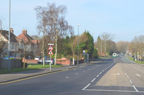
Here are my humble efforts from this morning, taken along Binley Road
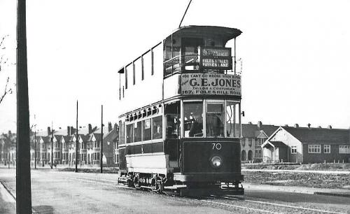
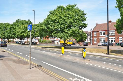
In the first one, tram 70 has just passed Uxbridge Avenue in April 1939 - across Binley Road, the houses on Momus Boulevard are only built as far as Anthony Way. The Triumph Recreation Ground clubhouse can be seen - the grounds, containing a cricket ground, several tennis courts and a bowling green, would soon be built on (there was another sports ground immediately beyond the Triumph, which contained, amongst other facilities, what is now Stoke Bowling Club's green)
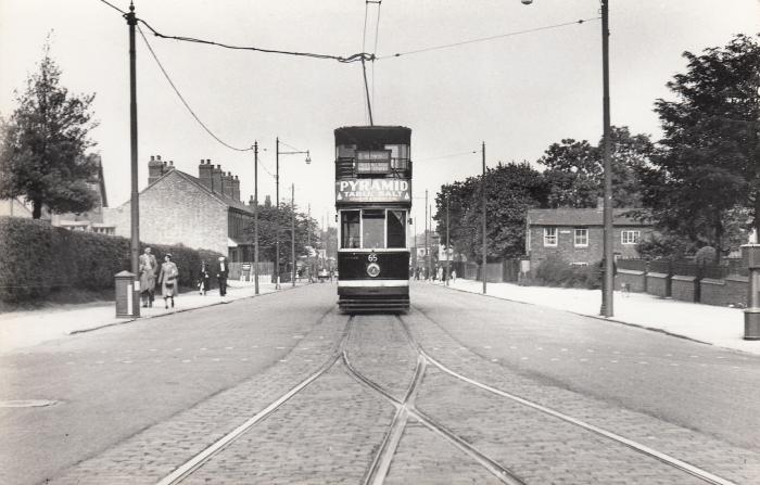
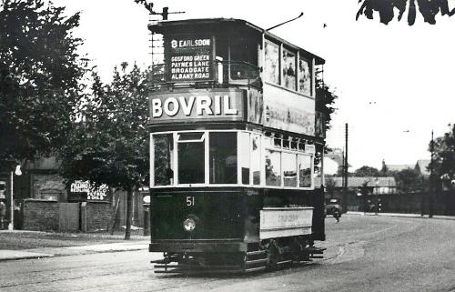
A few years earlier, tram 51 passes The Bulls Head PH - to the left of the tram can just be seen a pillar box with a sign on top pointing to the post office - this box was situated exactly opposite the stocks on Binley Road
 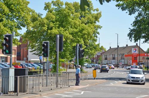
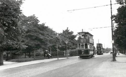
Back to 1931 for the final image, of tram 53 on Stoke Green passing the end of South Avenue - very little has changed apart from the road markings, traffic signs and, of course, the vehicles themselves - a couple sit on a bench in the "then" whilst in the "now" photo a man can be seen on a bench set further back
|
|
Memories and Nostalgia -
Then & now
|
NormK
bulkington
|
2 of 36
Mon 15th Jul 2013 2:07pm
Interesting to see those Cliff, I am surprised at the lack of signage in the Then shots, today there seems to be signs for everything  |
|
Memories and Nostalgia -
Then & now
|
PhiliPamInCoventry
Holbrooks
|
3 of 36
Mon 15th Jul 2013 2:33pm
Your pictures are fabulous, Cliff. An art-form in themselves. Most of us can press the shutter lever, but it takes a lot more to present a picture where each one tells a story like yours do. This is not flannel just because of our friendship.  |
|
Memories and Nostalgia -
Then & now
|
Memories Of Coventry
Coventry
|
4 of 36
Wed 24th Jul 2013 10:49pm
Uploaded onto Memories Of Coventry
End of Barras Green & Clay Lane
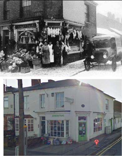
65 Dane Road - Shop - Stoke
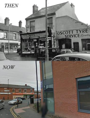
Corner of Stoney Stanton Road and Harnall Lane - Bon bons is now an eye centre with a chemist next to it - The tyre place & shop next to it has now gone and in its place is the new City College
Barras Heath Shops
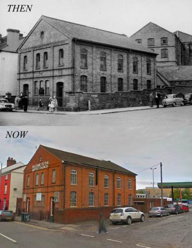
Lower Ford Street Church
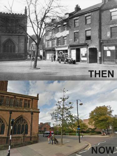
Looking up Cox street onto Jordan Well, the Coliseum building (part of the old Odeon) can be seen in both images at the top of the street
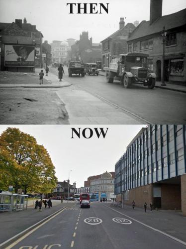
Fleet Street, demolished to make way for Corporation St.
Weavers Cottages at the junction of Freehold Street with Harnall Lane East. The Freemasons Tavern (public house) in the corner of the shot
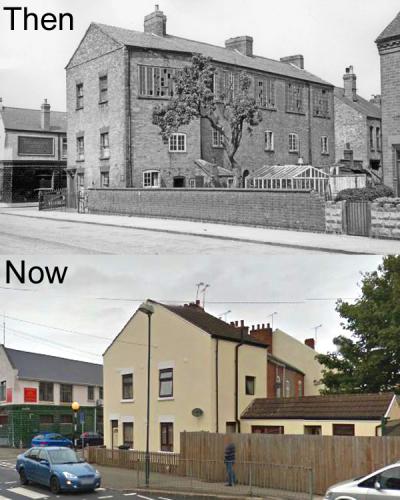
Cox Street - Top Image 1965 (Then) ? Copyright John Weir
Oak Inn, Gosford Street - Look at the Tory banner
 |
|
Memories and Nostalgia -
Then & now
|
Midland Red
Thread starter
|
5 of 36
Thu 25th Jul 2013 4:29pm
|
|
Memories and Nostalgia -
Then & now
|
dutchman
Spon End
|
6 of 36
Sun 28th Jul 2013 10:05am
On 24th Jul 2013 10:49pm, Memories Of Coventry said:
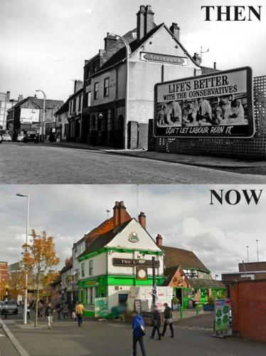
Oak Inn, Gosford Street - Look at the Tory banner
I remember that poster well. It was for the 1964 general election which the Tories lost by a very narrow margin.
Incidentally there was nothing behind that poster except for wasteland stretching back a considerable distance. It had been the site of a couple of furniture dealers and Court #41 before the war.
|
|
Memories and Nostalgia -
Then & now
|
Midland Red
Thread starter
|
7 of 36
Tue 3rd Sep 2013 10:56am
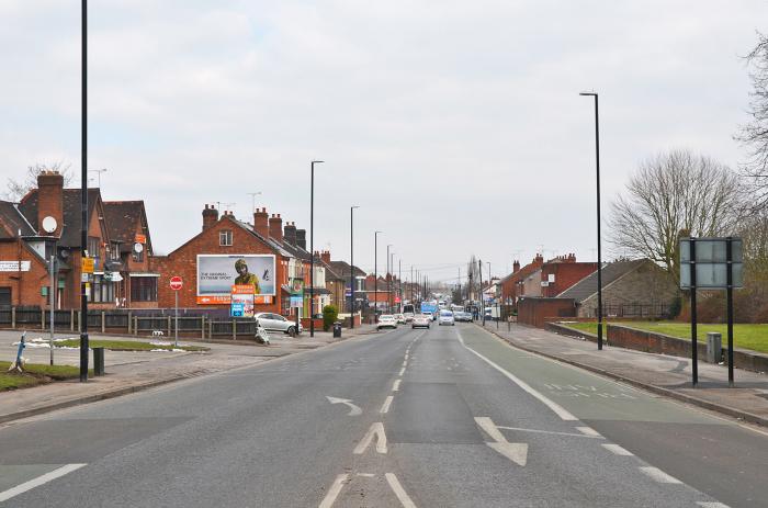
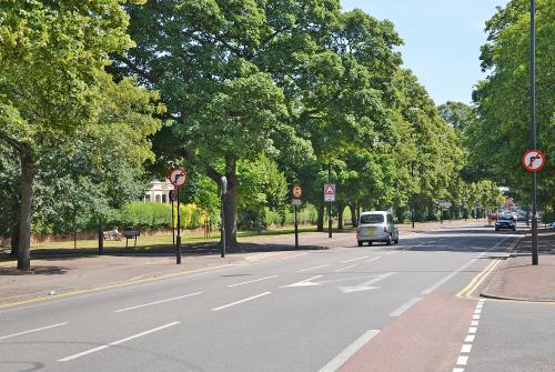
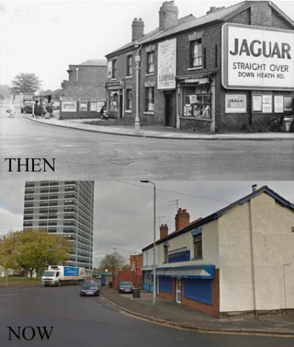
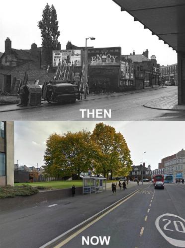
A couple more - this time, Binley Road, looking towards the city, from the junction with Princethorpe Way
The postcard view is from the 1950s and the photo was taken in 2012
 |
|
Memories and Nostalgia -
Then & now
|
deanocity3
keresley
|
8 of 36
Thu 12th Dec 2013 9:38pm
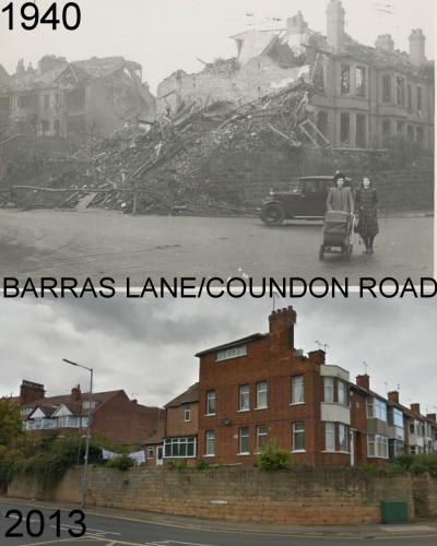
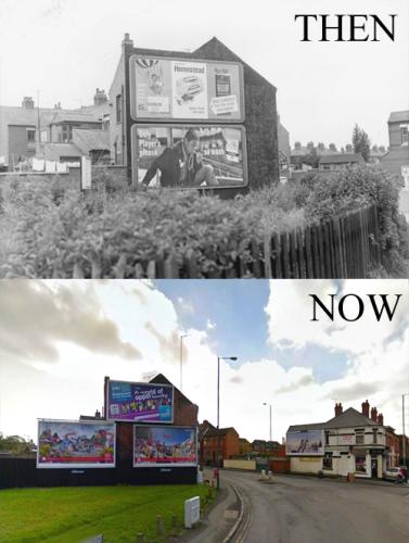
Barras Lane
 |
|
Memories and Nostalgia -
Then & now
|
deanocity3
keresley
|
9 of 36
Thu 12th Dec 2013 9:42pm
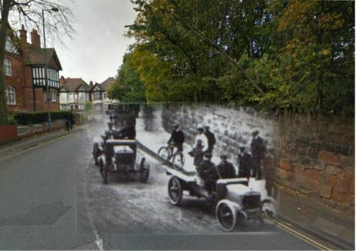
Sandy Lane
 |
|
Memories and Nostalgia -
Then & now
|
deanocity3
keresley
|
10 of 36
Thu 12th Dec 2013 9:44pm
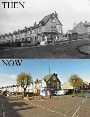
Moor Street, Earlsdon
 |
|
Memories and Nostalgia -
Then & now
|
deanocity3
keresley
|
11 of 36
Thu 12th Dec 2013 9:48pm
|
|
Memories and Nostalgia -
Then & now
|
mickw
nuneaton
|
12 of 36
Fri 13th Dec 2013 12:19am
On 12th Dec 2013 9:42pm, deanocity3 said:
Sandy Lane
Clever photo`s deano, well done!!! |
|
Memories and Nostalgia -
Then & now
|
NeilsYard
Coventry
|
13 of 36
Fri 13th Dec 2013 8:02am
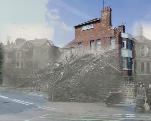
Love these kind of photos guys I drive past that house in Barras Lane most days taking my lad to Bablake and picture that bomb damage ever since it was first posted on here... |
|
Memories and Nostalgia -
Then & now
|
deanocity3
keresley
|
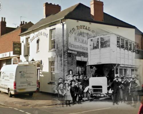
14 of 36
Fri 13th Dec 2013 8:50am
The Royal Oak in Earlsdon
 |
|
Memories and Nostalgia -
Then & now
|
deanocity3
keresley
|
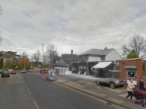
15 of 36
Fri 13th Dec 2013 8:52am
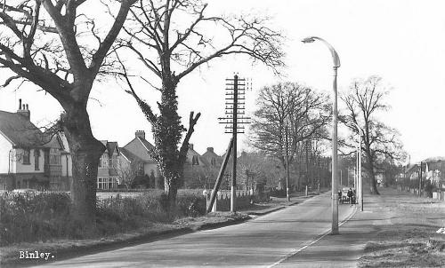
Brandon Road, Binley
 |
|
Memories and Nostalgia -
Then & now
|