Since I'm currently trying to disentangle West Orchard, and Rob wanted pictures of the street, I thought I'd round up some of the pictures and link to them here.
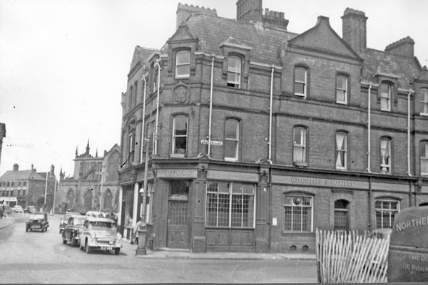
First are the buildings on the junction with
Smithford Street Fleet Street
Left side, City Arms pub:
Right side:

Left side
Apart from aerial photos (see later) I've no image for the next building on the left up to the right hand bend over the river.
Right side
There was this Co-Op building (image number 1)

And round the corner there was this one.

And within that block (picture number 3) was this building.

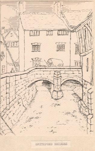
In the same area but from an earlier era we have Anne's picture looking from Smithford Street/Fleet Street along the river (covered over by the time the Co-op was built).
And looking in the opposite direction the top one of these two pictures.

Looking to the right from the same position, the bottom of these two images.

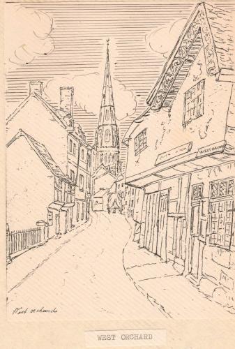
The next images I've got are by Sydney Bunney but they're not on the net. There's a similar picture to Anne's of the building on the bridge. There's a view of the back of that building and the building next door. There's a part picture of that building from the front and the next two. Half the Congregational Church is included in the book I've got and another picture that looks past that view, up West Orchard. You can see the gap to access the church on the left and all the buildings up to a kink in the road. In the distance, I think you can see the outer edge of the Market Hall.
A very similar view to that picture, but drawn earlier before the market was built, is the one Anne posted.
I haven't worked out exactly which buildings are which in the distance on the map, other than that they sit where the market will be built.
An aerial view shows the left hand side of the street quite well from the river, if you copy it and zoom in.

To the left of the Lion Foundry are the two buildings still standing in this picture.
Two standing
To see the rest of the north side of West Orchard once the Lion Foundry was built, there are several books with a photo taken in 1936 from Holy Trinity spire. One of the books I'd recommend is The City of Coventry - Images from the Past. It's got more Dr Troughton pictures and the view over West Orchard is on pages 108/9.
The photo of the Alms houses linked below, shows them to be located where the Lion Foundry was later built, but I don't think they would have filled the whole space. I don't know what else stood there and could do with some pictures or drawings of that area.

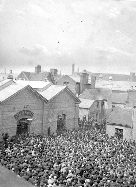
There are loads of pictures of the end of West Orchard.

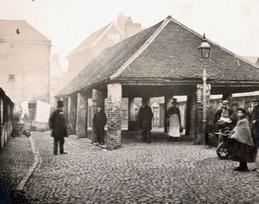
The Fish market.
Before the fish market was built there was the old market hall.
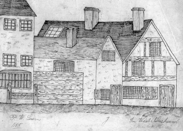
And a row of buildings that lead on to West Orchard (I've got a better sketch of these but I can't remember where I got it from).
Between this point and the buildings near the river I've not really sorted out what goes where. I've several pictures by Sydney Bunney and Dr Troughton but they're too far apart in time to make links. The south side of West Orchard is quite confusing.

There were also these buildings, row including Spread Eagle pub
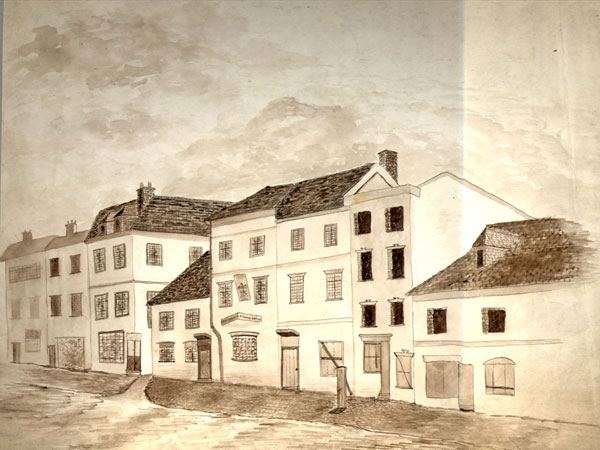
but they don't look like the other sketches of that side of the road. I've no street level photos of the old market hall or what was beyond it. Even the other aerial picture I've got doesn't answer my questions.

Hope these help others.


 That seemingly tiny distinction caused me much confusion over the years. As far as I can tell the Britannia Music Hall - the last building before Smithford Street - became the Great Boot Hall before being absorbed into the Co-Op building.
  Yeah, I'm always losing track of where the same road becomes another one, just by changing its name. That street is a swine for trying to keep the name straight.
 Can someone clear something up for me and mark on that aerial shot where the Sherborne was/is on Smithford Street?
 Was it one of the Britannia Buildings?
