|
NeilsYard
Coventry |
361 of 515
Thu 30th Aug 2018 9:29pm
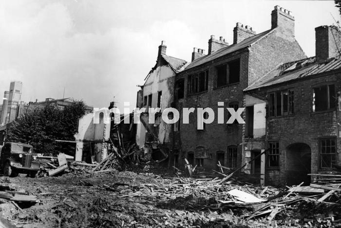
Further to earlier photos this is Thomas Street during its final days (I think the rears from some of the other images) from Mirrorpix - September 1960 and clearance for the Ring Road (GEC in the background)

|
| Streets and Roads - Spon Street | |
|
Wearethemods
Aberdeenshire |
362 of 515
Fri 31st Aug 2018 11:07am
The final houses in Thomas Street were demolished in 1967 |
| Streets and Roads - Spon Street | |
|
Prof
Gloucester |
363 of 515
Wed 26th Sep 2018 1:34pm
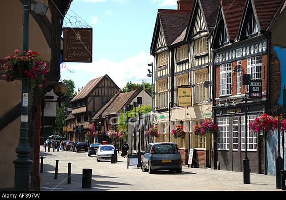
A familiar view in colour
|
| Streets and Roads - Spon Street | |
|
Prof
Gloucester |
364 of 515
Tue 2nd Oct 2018 7:32pm
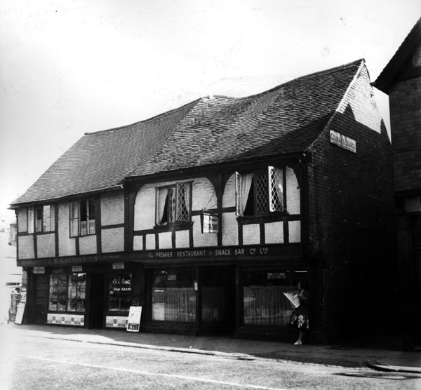
Goddard's paper shop LH of these two at start of Spon St
 |
| Streets and Roads - Spon Street | |
|
Prof
Gloucester |
365 of 515
Tue 16th Oct 2018 1:39pm
|
| Streets and Roads - Spon Street | |
|
Dreamtime
Perth Western Australia |
366 of 515
Tue 16th Oct 2018 4:28pm
On 2nd Oct 2018 7:32pm, Prof said:
Goddard's paper shop LH of these two at start of Spon St
I wonder if that restaurant used to be the Sun Sun Chinese in the late 50's later closed down owing to H & H restrictions. A regular haunt of ours but we survived.

|
| Streets and Roads - Spon Street | |
|
Malvern
Somerset |
367 of 515
Sun 28th Oct 2018 7:03pm
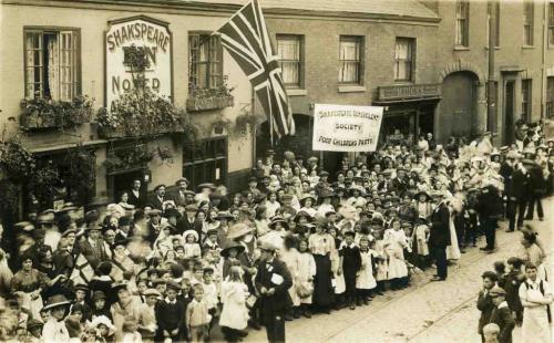
I know it's been a while but I am now able to provide a full update on where my ancestor lived in Spon Street. The first record is of my 5th great grandfather, Thomas Carvell (1753 to 1818), which shows him in Spon Street on the indenture form when he takes on an apprentice in 1810. His son William lived and worked from 19 Spon Street as shown on the 1841 and 1851 censuses. The Shakespeare and 19 were built in 1808 and the archway between them was the entrance to Shakespeare's Yard. I have added a photo from 1911. By this stage No.19 was a provisions shop called M Nicks.
In the mid 1850s Nos.20, 21 and 22 were known as Howes Houses and the yard behind was a silk dying factory employing 80 men. Howes Yard was later bought by Rotherhams. No.23 is, of course, still The Old Windmill.
I believe William left No.19 sometime between 1851 and 1853 when he is shown as living in the front shop of Newcombe's Yard further along Spon Street. William's wife Elizabeth died on 8th March 1854 and from 1857 William is shown on the electoral lists and 1861 census as living at No.163 on the other side of Spon street in front of Court 42. He died on 29th March 1866, aged 85, at Bonds Hospital.
In the 1861 census No.19 was occupied by the Howes's gardener, before becoming Morgans Provisions shop on the 1871 census and Nicks from 1881 onwards.
This is a link to Google StreetView showing the same view today.
Many thanks to the Coventry Watch Museum for their help with my research.
 Edited by Midland Red, 28th Oct 2018 10:21 pm (Link clarified)
Malvern
|
| Streets and Roads - Spon Street | |
|
Midland Red
|
368 of 515
Sun 11th Nov 2018 10:50am
"Secret Coventry: The incredible long-forgotten tale of Spon Street" - Telegraph photos |
| Streets and Roads - Spon Street | |
|
Helen F
Warrington |
369 of 515
Tue 13th Nov 2018 11:14am
A nice set of pictures MR |
| Streets and Roads - Spon Street | |
|
NeilsYard
Coventry |
370 of 515
Tue 13th Nov 2018 10:37pm
Agreed - just a shame the Telegraph's website is so flipping annoying with all those pop-up Ads! |
| Streets and Roads - Spon Street | |
|
Prof
Gloucester |
371 of 515
Mon 10th Dec 2018 3:11pm
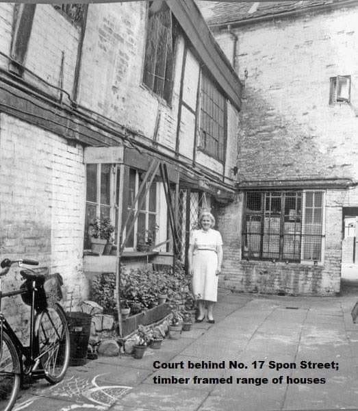 Saved by Christine Hill
 |
| Streets and Roads - Spon Street | |
|
NeilsYard
Coventry |
372 of 515
Mon 10th Dec 2018 10:10pm
I've been in touch with Patricia Webb whose Grandma that is in the photo - No.17 was right next to The Shakespeare Pub |
| Streets and Roads - Spon Street | |
|
Malvern
Somerset |
373 of 515
Thu 13th Dec 2018 7:55pm
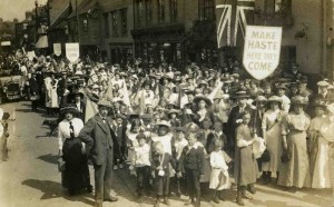
If you look at the photo of the 1911 parade from a few posts earlier in the thread you can see 18 (the Shakespeare), 19 (this was my great great grandfather's tailor's shop in the 1850s, and the archway goes through to Shakespeare's Yard, Court 7) and 20, 21 and 22, the entrance to the Rotherham's factory and then the Rotherham's Social Club. There is a picture taken at the same time looking the other way, which isn't quite so clear. You can see the Union Flag hanging outside the Shakespeare and just about make out the entrance to Court 6 in No 17 to the left.
Malvern
|
| Streets and Roads - Spon Street | |
|
NeilsYard
Coventry |
374 of 515
Tue 29th Jan 2019 12:11pm
Hi all 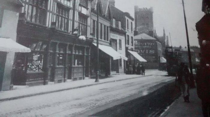
|
| Streets and Roads - Spon Street | |
|
Helen F
Warrington |
375 of 515
Tue 29th Jan 2019 1:54pm
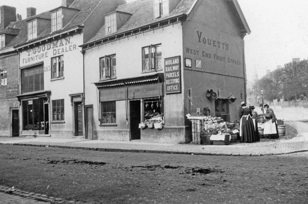 There were three buildings on the corner of Spon Street and Holyhead Road 2.3 of which can be seen in the photo above. There is a better version of the third building somewhere with a kid stood in front of what was a fairly grim looking building and a sign over the door/passageway saying 'St John's Commercial School.' In 1850 that was the Rising Sun and a building at the back, parallel with Holyhead Road was the Fairfax School. The Rising Sun moved to the left, at which point the school may have taken over the building on the Street and renamed itself. The Rising Sun (in its new position) and the building to the left of that were then demolished to build the current Rising Sun. The school also changed and the building now called the Fairfax House appeared - how many, if any original buildings are part of that block, I don't know but the sign says that the house was rebuilt in 1901. Charity set up in 1731.
Confused? I was. The number of times things moved is very bewildering when you try to correlate maps with images.
|
| Streets and Roads - Spon Street | |
Website & counter by Rob Orland © 2024
Load time: 551ms