|
Kaga simpson
Peacehaven, East Sussex |
46 of 83
Fri 8th Jan 2021 9:53am
Manor House,
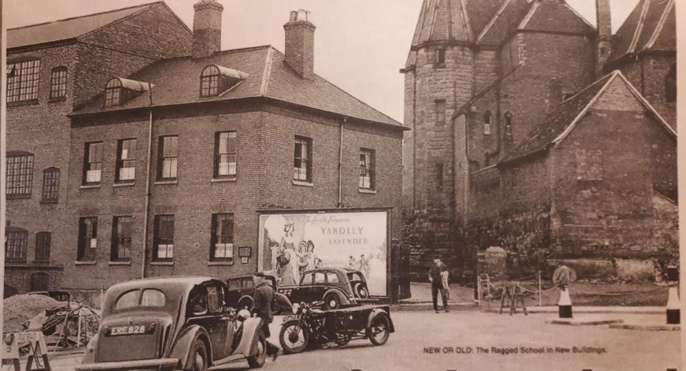
Great, but what date? I have no idea except after the war. |
| Streets and Roads - New Buildings | |
|
lolipop
arley |
47 of 83
Fri 8th Jan 2021 10:59am
On 31st Jan 2018 6:30pm, Sunbeam said:
Does anyone remember an outside coin operated hot drink vending machine in Coventry in or around New Buildings in the early sixties? I think it was somewhere around Exchange and Mart. From what I recall it seem to only give you half a cup every time you used it, but it was a great novelty at the time.
Sunbeam, I recall it was in front of, if I remember, a pet shop by the entrance to a dance school, but like others memory gets a bit hazy these days.Nicholson
|
| Streets and Roads - New Buildings | |
|
Kaga simpson
Peacehaven, East Sussex |
48 of 83
Fri 8th Jan 2021 11:06am
Rob
I believe in 1936 nothing had been changed in New Buildings since Victorian days except maybe the Golden Lion.
There were 'new rents' in Victorian times in Well Street, but no one seems to have mentioned - any ideas? |
| Streets and Roads - New Buildings | |
|
Helen F
Warrington |
49 of 83
Fri 8th Jan 2021 4:28pm
In the picture, I believe the first block of buildings on the left was erected between 1874 and 1888. The others are older. I think that these survived the war and seem to have been there still in the early 60s. |
| Streets and Roads - New Buildings | |
|
Rob Orland
Historic Coventry |
50 of 83
Fri 8th Jan 2021 6:22pm
On 8th Jan 2021 11:06am, Kaga simpson said:
Rob
I believe in 1936 nothing had been changed in New Buildings since Victorian days except maybe the Golden Lion.
There were 'new rents' in Victorian times in Well Street, but no one seems to have mentioned - any ideas?
Hi Kaga,
New Buildings, as a street, is a bit of a mystery to me, so I can only defer to your memories of its state in 1936. Along with Well Street they're among the places least photographed in our city. When I get time to check, there might more we can find out using newspaper archives and aerial photos, if there are any good enough quality images on Britain From Above. |
| Streets and Roads - New Buildings | |
|
Kaga simpson
Peacehaven, East Sussex |
51 of 83
Sun 10th Jan 2021 10:48am
Rob,
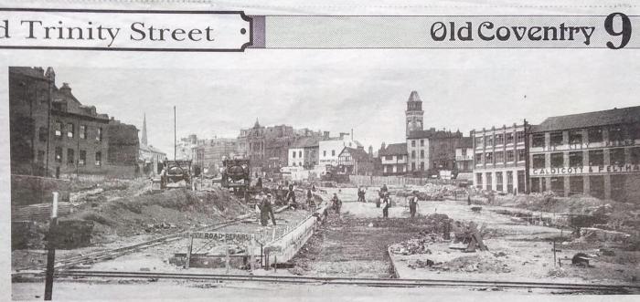
If you look at post 14 on topic Trinity Street, you see it as 1936, bottom right-hand is Caldicots, as 1850 when it was next to Brecks, not been touched as far as I can see. Trinity Street destroyed it. |
| Streets and Roads - New Buildings | |
|
20A-Manor House
Coventry |
52 of 83
Sun 10th Jan 2021 11:54am
On 8th Jan 2021 9:53am, Kaga simpson said:
Manor House,
Great, but what date? I have no idea except after the war.
I didn't note the date Kaga. I was looking at something else and that picture was on the same page. I just know it was during the 1960s. |
| Streets and Roads - New Buildings | |
|
Helen F
Warrington |
53 of 83
Sun 10th Jan 2021 12:40pm
Hi Kaga,
The problem with answering your question is that a lot happened between the Victorians and the war. The second issue arises from the shape of New Buildings. It started at the end of Ironmonger Row which was a few buildings beyond the bottom of Butcher Row/Bull Ring at what is now Nandos. It then travelled a short distance to the Meriden Tavern where it split and half went north to Hales Street the the other half continued east to the bottom of Hill Top. Originally it went further east by a few houses but it had been cut short by the Triumph Works. The south side then remained much the same apart from one timber building being rebuilt and cosmetic changes to the fronts of the timber buildings of which the Meriden Tavern belonged. Shortly after the planners had started designing Trinity Street on paper, Triumph bought a U shaped set of 3 terraces on the north side, next to their gates and built another factory unit there. From there the north side of that branch and the east side of the northern branch running all the way to the fire station didn't change much until they built over the river and the war. Butcher Row and the north side of Ironmonger Row were demolished to build the top end of Trinity Street and Owen Owen. Then the rest of New Buildings to the west was demolished, along with the Smithfield Market, Becks Yard and the east side of Palmer Lane. Caldicott's and a few buildings north of it on the west side of Palmer Lane were still there in 1939 and I assume they were destroyed during the war, although that's not guaranteed.
As a reminder, this is the area looking south. New Buildings was at the top left, Palmer Lane on the right.

|
| Streets and Roads - New Buildings | |
|
NeilsYard
Coventry |
54 of 83
Mon 11th Jan 2021 4:54pm

|
| Streets and Roads - New Buildings | |
|
Annewiggy
Tamworth |
55 of 83
Mon 11th Jan 2021 7:10pm
Yes, Neil, we get everywhere! I have the history of the Yardley company, I wrote to them a long time ago and they sent me a book! |
| Streets and Roads - New Buildings | |
|
Helen F
Warrington |
56 of 83
Mon 11th Jan 2021 9:28pm
You Yardleys get everywhere |
| Streets and Roads - New Buildings | |
|
NeilsYard
Coventry |
57 of 83
Tue 12th Jan 2021 10:20am
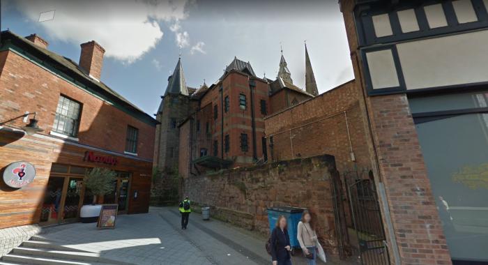
See, this is why we are so lucky to have you here with us Helen. I had not even really taken much notice of that building on the right if I am honest. It's interesting to see it in comparison to today...
 So has that wall behind where the ladies walking been added or was it originally part of that building? It's certainly old stone.
There is even an old blocked up doorway in it here, so it must be original?
Whilst I'm playing with Google Maps I've also never really noticed before what they've done to get it all in and how narrow The Flying Standard gets!!
 |
| Streets and Roads - New Buildings | |
|
Helen F
Warrington |
58 of 83
Tue 12th Jan 2021 1:16pm
It's all about teamwork Neil |
| Streets and Roads - New Buildings | |
|
mcsporran
Coventry & Cebu |
59 of 83
Wed 13th Jan 2021 6:30am
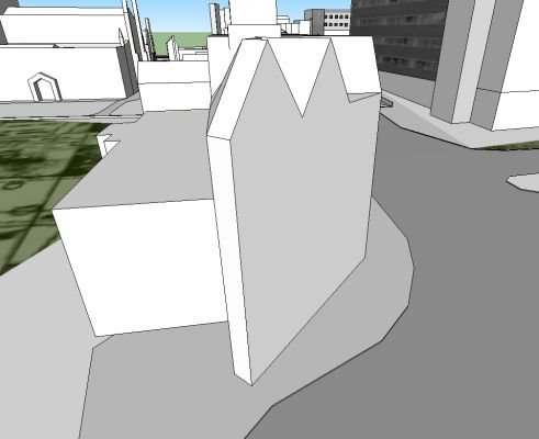
I well remember that narrow edge when I was trying to model the building, years ago now. It was all nice straight lines but every angle was odd and the ground not being level was a nightmare to get looking right. It certainly contributed to my eventual abandonment of the project.
 |
| Streets and Roads - New Buildings | |
|
NeilsYard
Coventry |
60 of 83
Wed 13th Jan 2021 11:01am
Looks like you were doing a good job to me mcsporran |
| Streets and Roads - New Buildings | |
This is your first visit to my website today, thank you!
4,129,505Website & counter by Rob Orland © 2024
Load time: 598ms