Mick Strong
Coventry
|
91 of 163
Tue 22nd Dec 2020 11:42am
On 21st Dec 2020 9:18pm, Rob Orland said:
For anyone interested in how the Stoke and Binley areas looked well over a century ago ("mostly fields" is the quick answer!), I have recently purchased a First Edition 1887 Ordnance Survey map, and it is now scanned and online for all to view.
Liked the little notes of "liable to flood" along the river!! |
|
Local History and Heritage -
Maps of Coventry
|
|
Robthu
|
92 of 163
Tue 22nd Dec 2020 3:01pm
|
|
Kaga simpson
Peacehaven, East Sussex
|
93 of 163
Wed 23rd Dec 2020 11:23am
All the way along the Sherbourne valley it has always flooded, the Victorian books are full of it. We could easily have made it a Venice or Amsterdam canal district from Spon End to Hillfields, and to me that was the intention in the 1920, but for some reason it got blocked.
Why did they build the hospital (Stoney Stanton Road) on such damp ground? And again, Walsgrave on damp ground? |
|
Local History and Heritage -
Maps of Coventry
|
heathite
Coventry
|
94 of 163
Tue 5th Jan 2021 4:05pm
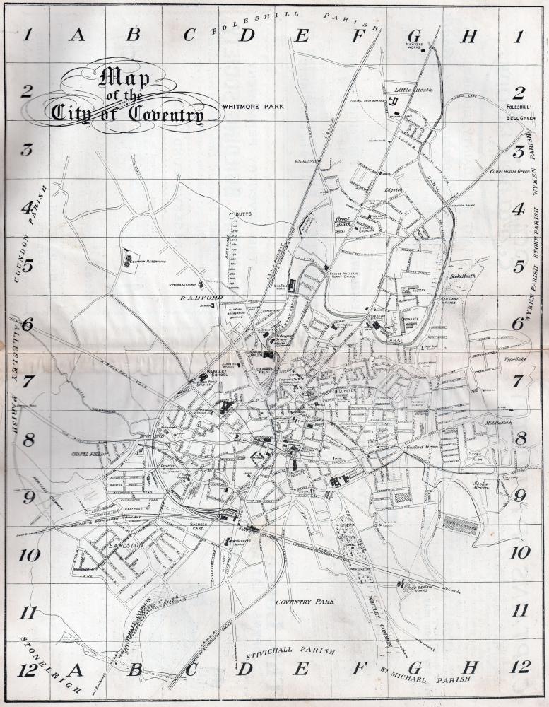
Hi all, here's a map of Coventry from the 1911 directory.
Not all directories include a map, they probably get ripped out and used on their own.
I think the map shows tram routes too. 

|
|
Local History and Heritage -
Maps of Coventry
|
belushi
coventry
|
95 of 163
Fri 5th Feb 2021 12:27pm
Excellent map Heathite. Interesting to see the route of the proposed Coventry Loop Line marked on.
It was authorised in 1907, and the three and a half mile line was opened seven years later. Not sure why it took so long; maybe someone on this forum may know the reason. |
|
Local History and Heritage -
Maps of Coventry
|
NeilsYard
Coventry
|
96 of 163
Fri 5th Feb 2021 12:30pm
Rob, I've been in touch with a lady called Carol Bates on FB. She has a copy of the Goad Plans in a very old book which she thankfully saved. She is happy for us to have scans whenever Covid is over. |
|
Local History and Heritage -
Maps of Coventry
|
Rob Orland
Historic Coventry
|
97 of 163
Fri 5th Feb 2021 1:17pm
That's great Neil, it'll be good to see them. Mind you, if they're the same size as mine - about 2 feet square - she'll need to photograph them! I did it in the back garden for good lighting, with the camera on a tripod. |
|
Local History and Heritage -
Maps of Coventry
|
Helen F
Warrington
|
98 of 163
Fri 5th Feb 2021 3:46pm
Very useful maps! I refer to them for house numbers and details like roof material. I always wonder which company did the other parts of the city. |
|
Local History and Heritage -
Maps of Coventry
|
Midland Red
|
99 of 163
Fri 1st Oct 2021 9:01am
|
|
Local History and Heritage -
Maps of Coventry
|
Rob Orland
Historic Coventry
|
100 of 163
Fri 1st Oct 2021 10:32am
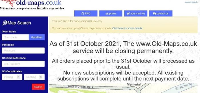
Oh no!!!  What will we do without those super old maps??? I wonder if they'll make them available elsewhere - a resource like that shouldn't be allowed to disappear? |
|
Local History and Heritage -
Maps of Coventry
|
Helen F
Warrington
|
101 of 163
Fri 1st Oct 2021 11:25am
Gulp  I'm going to be busy in the next few weeks making sure I've got some of the key bits. Especially the numbering after the war. There's still the Scottish archive but not quite so good for inner Coventry. Well spotted MR! |
|
Local History and Heritage -
Maps of Coventry
|
argon
New Milton
|
102 of 163
Fri 1st Oct 2021 2:13pm
Helen, I am not up to the job but I imagine quite a few members are, could a group of members search the maps in an organised search, each given an area, and cover the whole of the town before the deadline? |
|
Local History and Heritage -
Maps of Coventry
|
Helen F
Warrington
|
103 of 163
Fri 1st Oct 2021 2:36pm
It might be possible, argon.
We're not devoid of maps. There's Rob's excellent collection, the Fire Insurance maps and some in the Library pictures, but it won't be easy to direct people anymore.  |
|
Local History and Heritage -
Maps of Coventry
|
NeilsYard
Coventry
|
104 of 163
Fri 1st Oct 2021 2:51pm
Noooooooooooo! |
|
Local History and Heritage -
Maps of Coventry
|
NeilsYard
Coventry
|
105 of 163
Thu 7th Oct 2021 11:00am
Anyone know/use any good alternatives with similar search options to utilise once Old Maps has gone? |
|
Local History and Heritage -
Maps of Coventry
|

![First page [or press the "F" key] First page](../resource/colour_tint_inc.php?img_file=left-arrow-end.png&clr=AA5511)
![Previous page [or press the "Left arrow" key] Previous page](../resource/colour_tint_inc.php?img_file=left-arrow.png&clr=AA5511)
![Next page [or press the "Right arrow" key] Next page](../resource/colour_tint_inc.php?img_file=right-arrow.png&clr=AA5511)
![Last page [or press the "L" key] Last page](../resource/colour_tint_inc.php?img_file=right-arrow-end.png&clr=AA5511)


