Topic categories:
(Alphabetical)

Local History and Heritage

Aerial views of Coventry

You need to be signed in to respond to this topic

First pagePrevious page

Displaying 166 to 171 of 171 posts

Page 12 of 12

1 2 3 4 5 .. 8 9 10 11 12
No actionNo action
171 posts:
Order:   

rocksolid
Bristol
166 of 171  Sat 14th Sep 2024 10:59am  

On 13th Sep 2024 10:42am, NeilsYard said: I thought I had shared this one before but this Street level view shows what was then the Matterson's building close-up with the Cocaine Ad in Robs aerial -
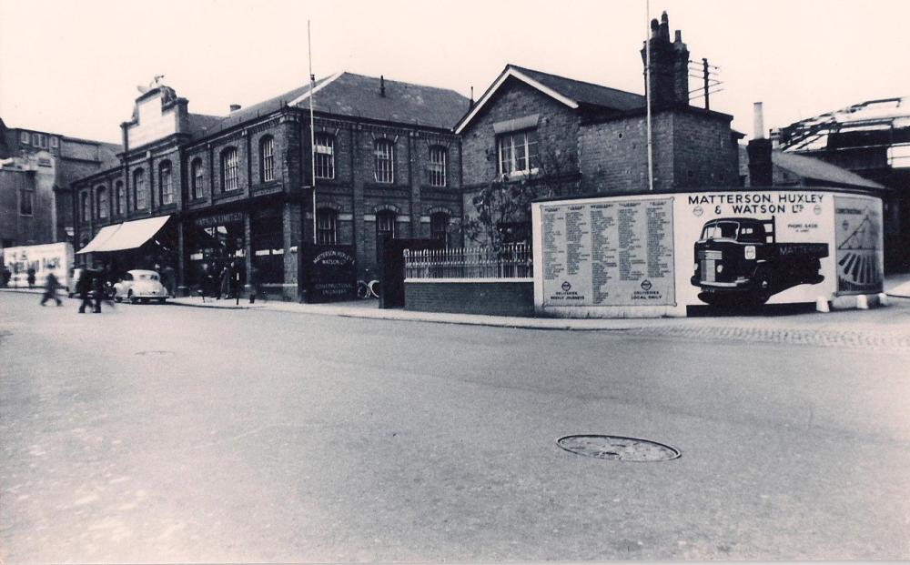
I guess this shot was taken late 1940s like the other similar one in the Hales Street thread posted by Neil although this one has a more up-to-date lorry advertised, the older one could even be just pre-war? That curved wall has achieved a certain fame through this forum, hasn't it? It was obviously well-used for advertising purposes.
Local History and Heritage - Aerial views of Coventry
Annewiggy
Tamworth
167 of 171  Sat 14th Sep 2024 12:16pm  

I think this is the weigh-bridge on Rob's now and then of Hales Street. If this picture appeared now you would think it was the public toilets. Hales Street
Local History and Heritage - Aerial views of Coventry
NeilsYard
Coventry
168 of 171  Wed 25th Sep 2024 4:25pm  

OK so pre-War date this one - It's got some great detail and I'm slightly puzzled by what the road is front right and that timbered building? I think it might be a rare capture of that era of Bayley Lane?
Local History and Heritage - Aerial views of Coventry
NeilsYard
Coventry
169 of 171  Wed 25th Sep 2024 4:49pm  

I think this is a similar view after the blitz and really shows the destruction Sad 
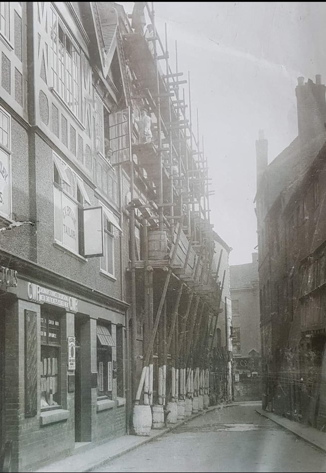
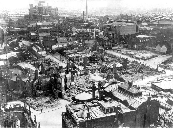
And that timbered building bottom right is this one seen on the Bayley Lane thread - the pattern is the same -
Local History and Heritage - Aerial views of Coventry
Rob Orland
Historic Coventry
170 of 171  Thu 26th Sep 2024 9:25am  

On 25th Sep 2024 4:25pm, NeilsYard said: OK so pre-War date this one - It's got some great detail and I'm slightly puzzled by what the road is front right and that timbered building? I think it might be a rare capture of that era of Bayley Lane?
That's a smashing photo, Neil. I was just looking on this 1937 map, and I think you must be right about that timbered building being Bayley Lane. I think we can also see the double row of tiny terraced houses in Freeth Street, just left of centre. And isn't the rear of the Gaumont Cinema huge! Oh, so many things of interest in aerial photos - like staring at a 3D map from funny angles!
Local History and Heritage - Aerial views of Coventry
Helen F
Warrington
171 of 171  Thu 26th Sep 2024 3:57pm  

Yes, the timbered building was Bailey Lane. It was not an original timber frame but was in fact a new build covering number 44 and 45. In 1819 William Henry Brook painted the same location and captured the very grand original. It was there when the drawings for Coventry Past and Passing were made and even Dr Troughton sketched it from the other direction. On the end was a star symbol and I wonder if the building had been the Star Inn at one point? By the time the Board of Health map was drawn it had been demolished and a shed plus a passage replaced it. The left hand side of the passageway probably followed the original passage into the inn yard and even in 1850 there were still a coach house and stables in the yard at the back.
Local History and Heritage - Aerial views of Coventry

You need to be signed in to respond to this topic

First pagePrevious page

Displaying 166 to 171 of 171 posts

Page 12 of 12

1 2 3 4 5 .. 8 9 10 11 12
No actionNo action

Previous (older) topic

A.G.E.D. Coventry
|

Next (newer) topic

Airbase, Baginton
You are currently only viewing topics in the Local History and Heritage category
View topics in All categories
 
Home | Forum index | Forum stats | Forum help | Log out | About me
Top of the page

This is your first visit to my website today, thank you!

3,897,512

Website & counter by Rob Orland © 2024

Load time: 463ms