|
Helen F
Warrington |
46 of 192
Fri 17th Jan 2020 9:47am
North side, replaced by the Council House. Have a look at the fire insurance maps at the British Library (Rob's are too late). |
| Streets and Roads - Earl Street (inc. Palace Yard) | |
|
Helen F
Warrington |
47 of 192
Fri 17th Jan 2020 11:22am
It is a rare photo. Eventually more might pop up. Off ebay, I grabbed a copy of a postcard for a shop near the east end of Earl Street near Bayley Lane. Not part of the block demolished for the Council House but not covered elsewhere. Some of the shops seem to have had postcards as advertising.
Kaga you need to expand that comment to explain what you mean. |
| Streets and Roads - Earl Street (inc. Palace Yard) | |
|
Annewiggy
Tamworth |
48 of 192
Fri 17th Jan 2020 11:26am
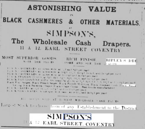
An advert from 1886. They were still advertising until at least 1899. They moved in 1901 to the corner of Earl Street and St Mary Street
 |
| Streets and Roads - Earl Street (inc. Palace Yard) | |
|
Helen F
Warrington |
49 of 192
Fri 17th Jan 2020 11:52am
Thanks Anne. |
| Streets and Roads - Earl Street (inc. Palace Yard) | |
|
NeilsYard
Coventry |
50 of 192
Fri 17th Jan 2020 12:09pm
Looking at those Fire Maps they occupied most of that front row. |
| Streets and Roads - Earl Street (inc. Palace Yard) | |
|
Kaga simpson
Peacehaven, East Sussex |
51 of 192
Fri 17th Jan 2020 12:12pm
Helen F. I thought all three were coming in through from the entrance on Earl Street, the south side not being touched till the blitz? |
| Streets and Roads - Earl Street (inc. Palace Yard) | |
|
Helen F
Warrington |
52 of 192
Fri 17th Jan 2020 12:21pm
Kaga, yes, there were 3 remaining buildings on the corner of Hay Lane after the bulk of the stretch had gone, 1 or 2 of them were still there even as they were building the council house but number 11 was further east and demolished some time before 1901. As you say, the south side wasn't part of that demolition, although bits of it were regularly being changed. |
| Streets and Roads - Earl Street (inc. Palace Yard) | |
|
NeilsYard
Coventry |
53 of 192
Fri 17th Jan 2020 12:25pm
On 17th Jan 2020 11:22am, Helen F said:
It is a rare photo. Eventually more might pop up. Off ebay, I grabbed a copy of a postcard for a shop near the east end of Earl Street near Bayley Lane. Not part of the block demolished for the Council House but not covered elsewhere. Some of the shops seem to have had postcards as advertising.
Any chance of seeing that one Helen? |
| Streets and Roads - Earl Street (inc. Palace Yard) | |
|
Helen F
Warrington |
54 of 192
Fri 17th Jan 2020 3:05pm
If it turns up again, I'll link to it. It went in my unsorted pile of which there are now thousands! |
| Streets and Roads - Earl Street (inc. Palace Yard) | |
|
NeilsYard
Coventry |
55 of 192
Mon 17th Feb 2020 9:34am
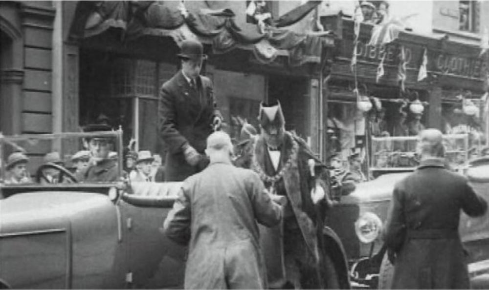
Morning all  *UPDATE* Dean has just sent me the link to this - the image was a captured still from this film which includes at 02:46 the section of that row - The Council House would only be about three years old here - great rare footage-find!
1923 Prince of Wales
|
| Streets and Roads - Earl Street (inc. Palace Yard) | |
|
Kaga simpson
Peacehaven, East Sussex |
56 of 192
Mon 17th Feb 2020 11:52am
Immensely popular at the time the Prince of Wales stood only five and a half feet tall, and as you can see he didn't look short, there were few six-footers in those days. Gone was most of the cloth caps - Coventry in its Sunday best.
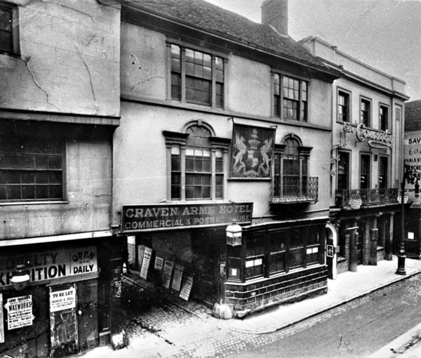
Helen, wasn't the old White Bear about where Gibberd stands, re-named in 1811 to the Craven after the popular and humorous Lord Craven by his friends? Also one of Coventry's leading Coaching Posts. |
| Streets and Roads - Earl Street (inc. Palace Yard) | |
|
NeilsYard
Coventry |
57 of 192
Mon 17th Feb 2020 12:37pm
Kaga the White Bear was further along westwards in High Street -
 |
| Streets and Roads - Earl Street (inc. Palace Yard) | |
|
Helen F
Warrington |
58 of 192
Mon 17th Feb 2020 1:30pm
Gibberds was right on the corner with Little Park Street and replaced some 2 storey half timbered, jettied buildings. At the same time the entrance to LPS was widened. One of Coventry's celebrated vaulted medieval cellars was on or near that corner plot. There is a theory that it might still be there.
As Neil writes, the Craven/White Bear was further west. About halfway along the High Street. Confusingly The High Street and Earl Street appear somewhat interchangeable through the ages and few people were sure where they started or stopped. So a reference to the castle (real one not the pub) on Earl Street could as easily mean the High Street. |
| Streets and Roads - Earl Street (inc. Palace Yard) | |
|
Kaga simpson
Peacehaven, East Sussex |
59 of 192
Mon 17th Feb 2020 3:56pm
Helen,
There you go, another one of those royal warrants, but this one must have been one of the oldest, on the Craven. Gilberts in the Burges had one. Fortune and Mason also - they were ten-a-penny at one time.
Yes, I suspected the Craven was a little higher, but a little lower, could have been Jordan Well. east of the Council House was a large tract of waste land surrounded with a cattle fence for many years through the war. |
| Streets and Roads - Earl Street (inc. Palace Yard) | |
|
Kaga simpson
Peacehaven, East Sussex |
60 of 192
Mon 17th Feb 2020 4:02pm
Helen
I missed that first line above the photo, my book says the White bear was changed to the Craven. |
| Streets and Roads - Earl Street (inc. Palace Yard) | |
Website & counter by Rob Orland © 2024
Load time: 615ms