NeilsYard
Coventry
|
121 of 192
Tue 4th Aug 2020 10:05am
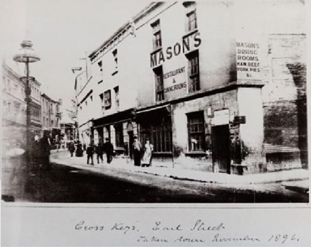
Helen, you're going to like this one - my friend Dean Nelson on the True Cov FB page found it. This is the first image I have seen of the Cross Keys on Earl St, right opposite the Palace Yard on the corner of St Mary St. It was demolished to build the Council House along with the rest of the row visible - late 1890's. I don't think we have seen much of the row on that north side in that section before?
|
|
Streets and Roads -
Earl Street (inc. Palace Yard)
|
Helen F
Warrington
|
122 of 192
Tue 4th Aug 2020 10:20am
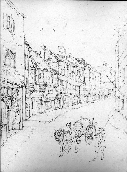
Woo hoo! Exactly what I've been looking for. It ties in with a Troughton looking the same way. Thanks Neil and Dean.
|
|
Streets and Roads -
Earl Street (inc. Palace Yard)
|
Prof
Gloucester
|
123 of 192
Fri 11th Sep 2020 8:50pm
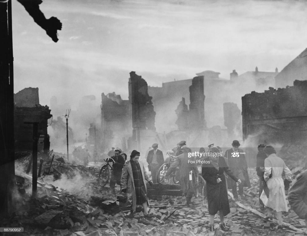
Earl St devastation. |
|
Streets and Roads -
Earl Street (inc. Palace Yard)
|
|
Dreamtime
|
124 of 192
Mon 14th Sep 2020 6:52am
|
|
Kaga simpson
Peacehaven, East Sussex
|
125 of 192
Mon 14th Sep 2020 3:31pm
Helen,
The last time a water cart was used for selling water was 1934/5 in Coventry as far as I know. But we do have a photo of one on this forum from an early time when the wells couldn't cope. |
|
Streets and Roads -
Earl Street (inc. Palace Yard)
|
Helen F
Warrington
|
126 of 192
Mon 14th Sep 2020 3:56pm
Interesting Kaga, I thought it was wine but yes, it could be water. The sketch isn't dated but I'm guessing that it was early to mid 1800s. Troughton often sketched areas just before they were demolished or given a brick front. |
|
Streets and Roads -
Earl Street (inc. Palace Yard)
|
Kaga simpson
Peacehaven, East Sussex
|
127 of 192
Tue 15th Sep 2020 9:07am
Helen,
Yes, I wrote the story of the water carriers on the topic Canals of Coventry post 386, there were 5/6 of them in 1820, due to the influence of a rise in population and shortage. The part Coventry canal becoming derelict in 1928 then Coventry had to find other means in 1934/35 of supplying water when we had huge droughts. |
|
Streets and Roads -
Earl Street (inc. Palace Yard)
|
Kaga simpson
Peacehaven, East Sussex
|
128 of 192
Tue 15th Sep 2020 11:18am
Some of you seem to worry about street ending or beginning or street numbers - well, that came in over scores of years. When the city was small everyone was familiar with each building in the neighbourhood, they didn't need to know numbers,
Coventry had a postmaster back in 1663 but he didn't have a postal round as we know it, the post boy rode behind the special stagecoach on packhorse, and between them they delivered merchandise. The goods postal wagons were heavier, wider, had long deep chests for the goods. Pulled by six to ten horses. Often a wheel lost a spoke, an axle tree broke, or a perch snapped in two.
And every shop or who lived where was known, it wasn't till 1840 that stamps appeared and street numbers appeared and the post service began as we know it.
PS. The famous Stanley Gibbons (philately) had five wives, four of whom deceased him - some talk - one died of a wasting disease, one a liver ailment, etc. He had been trained as a pharmacist. |
|
Streets and Roads -
Earl Street (inc. Palace Yard)
|
Helen F
Warrington
|
129 of 192
Tue 15th Sep 2020 1:16pm
Thanks Kaga. These snippets of info are both interesting and useful.
We don't worry about house numbers as such but they're useful to precisely locate properties, businesses and relatives. I'm usually looking to match a sketch or photo with a map location. A business on an old sketch might not have a street number but I might be able to trace it forward in time and changes of owners to a more modern business that does have a street number. Then I can then pinpoint it on the modern map and trace the plot back in time to the oldest maps. Get enough buildings located on the map and I can work out the others. |
|
Streets and Roads -
Earl Street (inc. Palace Yard)
|
NeilsYard
Coventry
|
130 of 192
Mon 7th Dec 2020 12:01pm
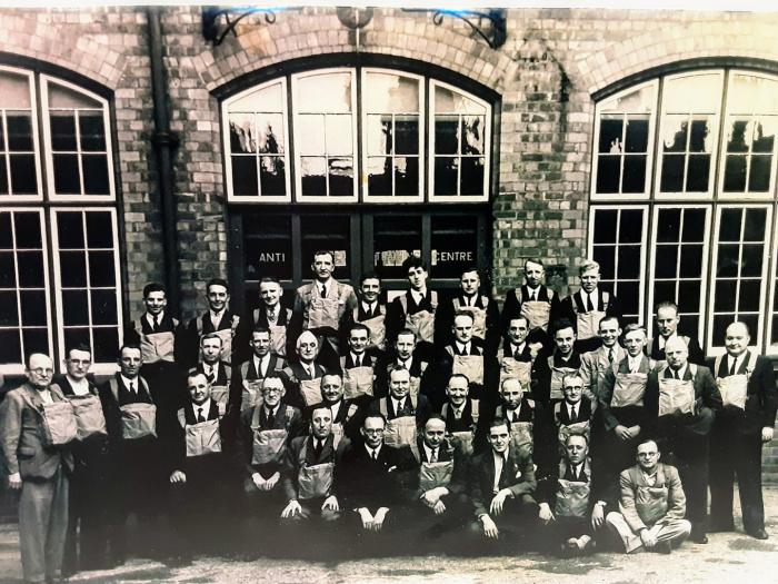
Another FB find here. Although not a lot of area detail, this is listed as being outside the Technical Institute which was east of Palace Yard. Dated 13th September 1937 it was apparently a new Anti Gas Training Centre although I'm slightly surprised they were expecting gas attacks that long before war actually started.
|
|
Streets and Roads -
Earl Street (inc. Palace Yard)
|
Annewiggy
Tamworth
|
131 of 192
Mon 7th Dec 2020 1:12pm
Neil, newspaper articles say that 13th September 1937 was the day the training centre opened at what they call the old technical college in Earl Street. It was thought to be the first in the country. By 1938 there were 3 million respirators in the respirator store at the Challenge works, Foleshill for Coventry and the surrounding areas. I believe that some of the gas masks were made at the Reliant factory in Tamworth. |
|
Streets and Roads -
Earl Street (inc. Palace Yard)
|
NeilsYard
Coventry
|
132 of 192
Mon 11th Jan 2021 4:51pm
I hope Moriarty does not mind but I found a copy of the same rare Earl St shot in my pile of donated clippings which I have enlarged.
Looking at Helen's great map the passageway in the centre led to the Technical Institute and the picture in my post above #130 
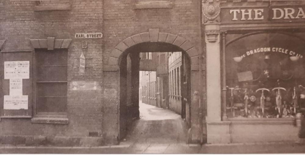 |
|
Streets and Roads -
Earl Street (inc. Palace Yard)
|
NeilsYard
Coventry
|
133 of 192
Mon 11th Jan 2021 5:53pm
BTW that one is clearly a cut down shot as it appeared in the Telegraph so there must be a full photo out there with more lovely detail. I need to get on to them  |
|
Streets and Roads -
Earl Street (inc. Palace Yard)
|
Helen F
Warrington
|
134 of 192
Mon 1st Mar 2021 4:06pm
The 1896 Architect's drawing alternatives for the Council House in Rob's collection are interesting, especially the Earl Street stretch. It shows an early front to Wheelers and one of the remaining Earl Street Shops on the left.
I've blown up the sketched building and I think it might be the one on the right of the photo but I'm not 100% sure.
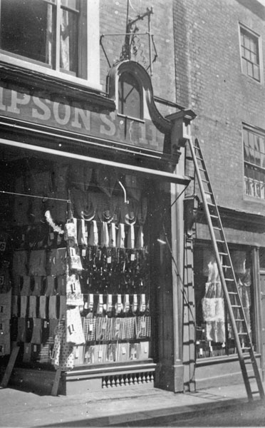 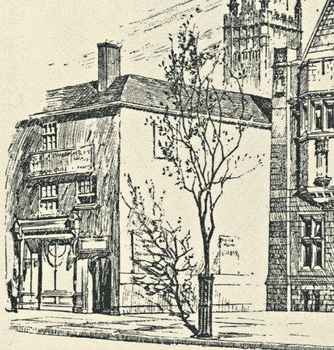
Clearly at that point in time they weren't sure that they'd get the whole of Earl Street to Hay Lane and were planning to run the building along St Mary Street instead.
|
|
Streets and Roads -
Earl Street (inc. Palace Yard)
|
NeilsYard
Coventry
|
135 of 192
Tue 2nd Mar 2021 2:40pm
Wasn't Wheelers on the corner of St Mary St though Helen? The sketch to the right looks like the LH side of the Council House so would be corner of Hay Lane? |
|
Streets and Roads -
Earl Street (inc. Palace Yard)
|
